Coordinate System is the most general term for a system that includes coordinates. Spatial Reference System is a coordinate system used to reference spatial information, typically to the surface of the earth. You will see these two terms, and their acronyms, used interchangeably in GIS.
Spatial Reference Systems or Coordinate Systems, include two common types:
1. Geographic Coordinate Systems: Location on an ellipsoid is defined by latitude and longitude that specifies the angle between any point and the equator, and the angle between any point and the prime meridian.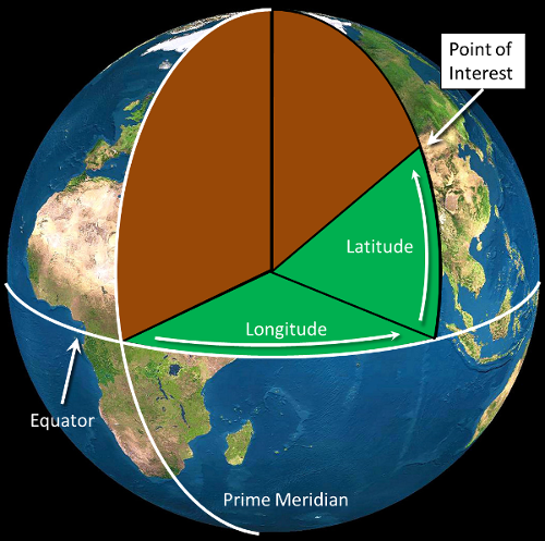
2. Projected Coordinate Systems: Location is defined on a flat surface using Cartesian coordinates (i.e., x and y) that specify horizontal and vertical position.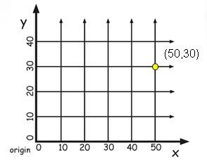
All projected coordinate systems are based on a GCS (geographic coordinate system)
Try not to confuse this with the more general terms:
Esri uses the following terms to refer to spatial reference systems:
A geographic coordinate system or GCS consists of:
A GCS includes an ellipsoid, a prime meridian, and units. Almost every GCS in use has the prime meridian at Greenwich England and the units are always in degrees. Because of this, the GCS really just provides the datum. Since the datum just includes the ellipsoid, or shape of the earth, we can consider a GCS to just include an ellipsoid..
You can see the contents of a GCS by opening a ".prj" file for a shapefile in "Notepad" or another text editing application. Use the ".prj" from a shapefile containing data in geographic coordinates and you'll see the datum, ellipsoid, units, and prime meridian for that data set.
Projected Coordinate Systems consist of:
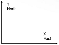
Projected coordinate systems use rectangular or Cartesian Coordinates. You learned about rectangular coordinate systems in geometry and used X and Y as the values. In GIS, we use X and Y but also "Easting" for X and "Northing" for Y.
For spatial analysis, we should almost always use a projected coordinate system. The most commonly used systems for Humboldt County are:
© Copyright 2018 HSU - All rights reserved.